
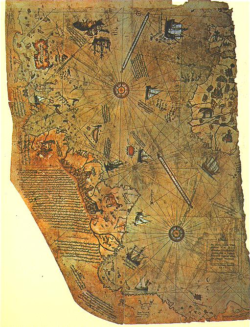
In 1929, scholars working in the archives of the Ottoman Empire in Turkey’s Topkapi Palace Museum made an exciting discovery: a section of an early 16th-century Ottoman map based in part, apparently, on the original chart drawn or used by Christopher Columbus and showing his historic discoveries in the New World. The map, signed by an Ottoman captain named Piri Reis, was dated 1513, just 21 years after Columbus discovered America.
A Turkish friend of mine was kind enough to locate and obtain an official Turkish Navy copy of the Piri Reis map as it is displayed in the museum in Istanbul…with one key difference. The Arabic comments in the margins have been replaced by English translated comments.